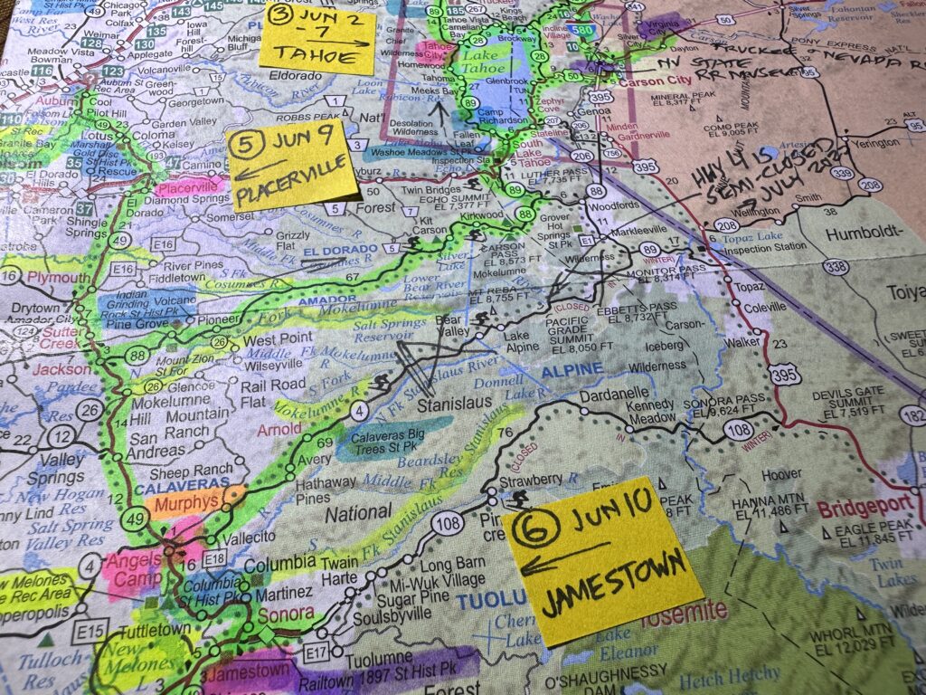
Posting on Friday morning – from Angels Camp – about Thursday, June 1st
Fresno – Friant Dam – Highway 41 – Yosemite Valley – Highway 140 – Merced River – Highway 49 – Angels Camp
Yesterday I had planned to drive from Fresno to Friant Dam, then visit the California State Mining and Minerals Museum via “Highway 49.” It is named for the gold rush of 1849, and runs through california’s gold country in the western Sierra foothills.
Next I planned to spend a good three hours or so at Calaveras big trees, walking among some of the largest trees on earth. Finally, I was to head to my next motel in Angels Camp.
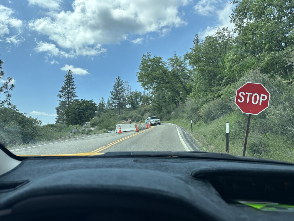
Well, I did visit the dam, and I did get to Angels Camp, but the rest was completely different. What good are plans If you can’t change that at the last minute, right? As I approached the turn off to go up into Yosemite I figured I should at least check and see if the roads were open and what the traffic looked like. This is usually high tourist season, and the whole valley is especially dramatic right now because of all the melting snow , so it has potential to be very crowded.
On the other hand, they have been experiencing a lot of flooding, and have been canceling people’s reservations left and right – a big disappointment for vacationers, especially people coming from other countries just to see Yosemite. A lot of the surrounding businesses are really suffering, too, because traffic is way down.
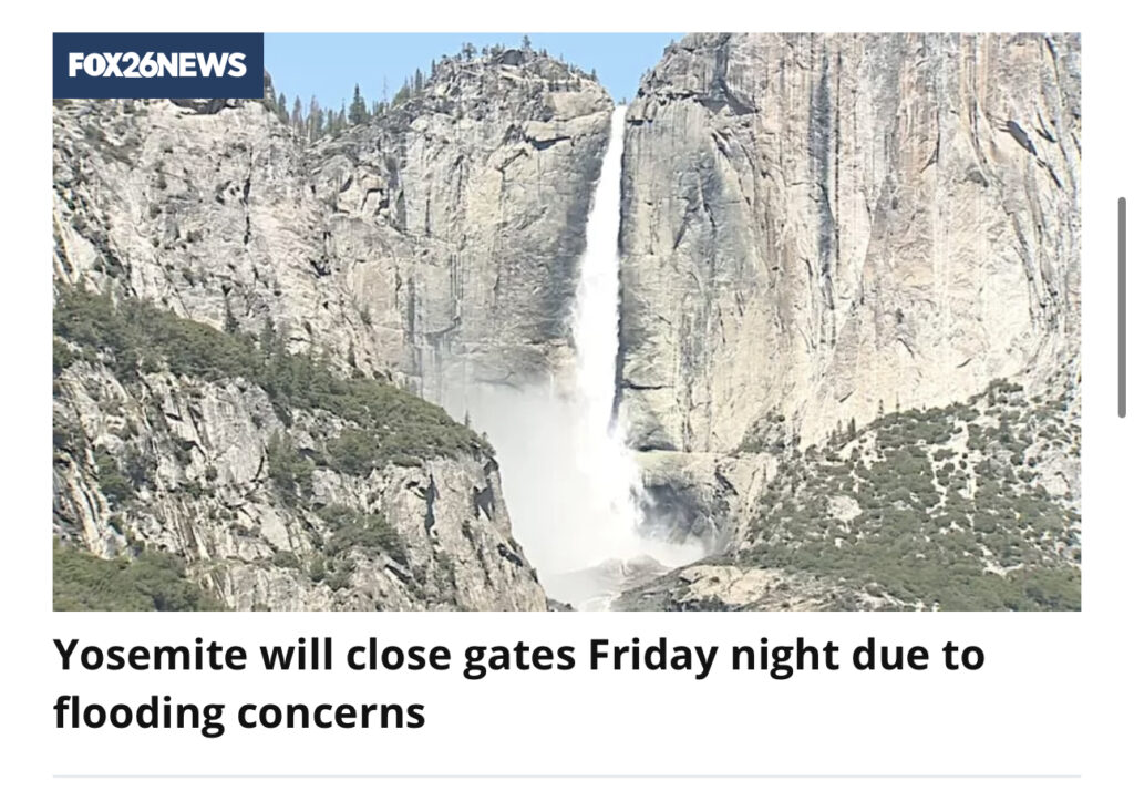
I got very lucky! Yes, the highway was open, and my maps app showed it green the whole way – no traffic jams. So what the heck! I headed up to Yosemite Valley instead. This is the second time I have visited Yosemite on a whim. The first time was coming up the other side from Lee Vining.
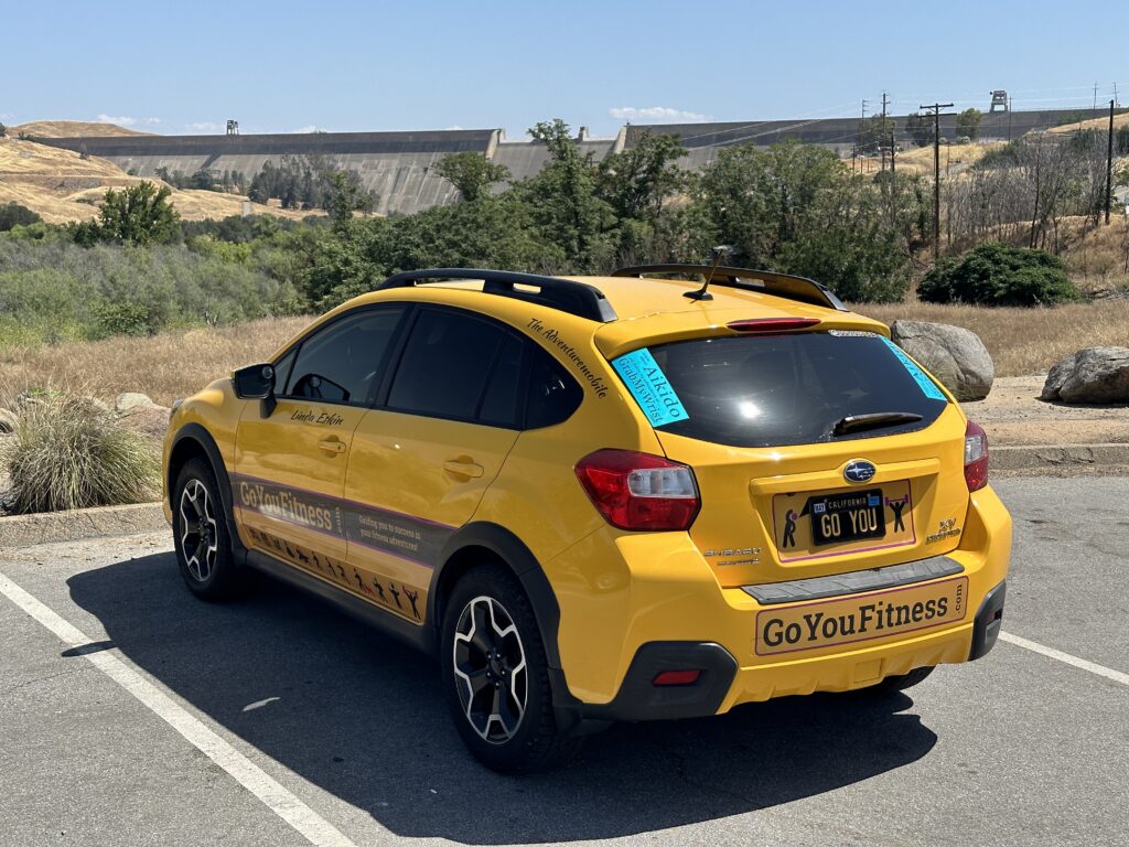
My Aiki Road Trip 2023
This post is part of a series: My Aiki Road Trip 2023. For about two weeks I’m sharing my adventures and photos on my way to the Aikido at Granlibakken retreat at Lake Tahoe, insights and fun during a week of great Aikido training with dear friends, and the trip back. I’m driving through the Mojave Desert, San Joaquin Valley, California’s Gold Country, and High Sierra, exploring the historic water situation — rivers, reservoirs, dams, flooding, and Tulare Lake, plus gold rush history, and amazing nature and scenery.
At the bottom of each post I include resources for further exploration about each day’s adventures – books, videos, maps, links, images, etc.. For the trip in general, here are more California History Resources for Road Trips.
I mostly posted these from my phone, with limited Internet access. There may be typos and glitches. I’ll come back to fix them later. You can email me at grabmywristaikido@gmail.com.
I had initially planned to get up very early each day to take advantage of as much daylight as possible. But on Thursday I had to sleep in as a matter of health and safety. I do pretty well on very little sleep on occasion, but too many days in a row, or too little one night isn’t good. So by the time I had breakfast at the hotel, packed everything up, and did some work, and it was somewhere around 10 AM by the time I got out the door.
Friant Dam, and a Personal History
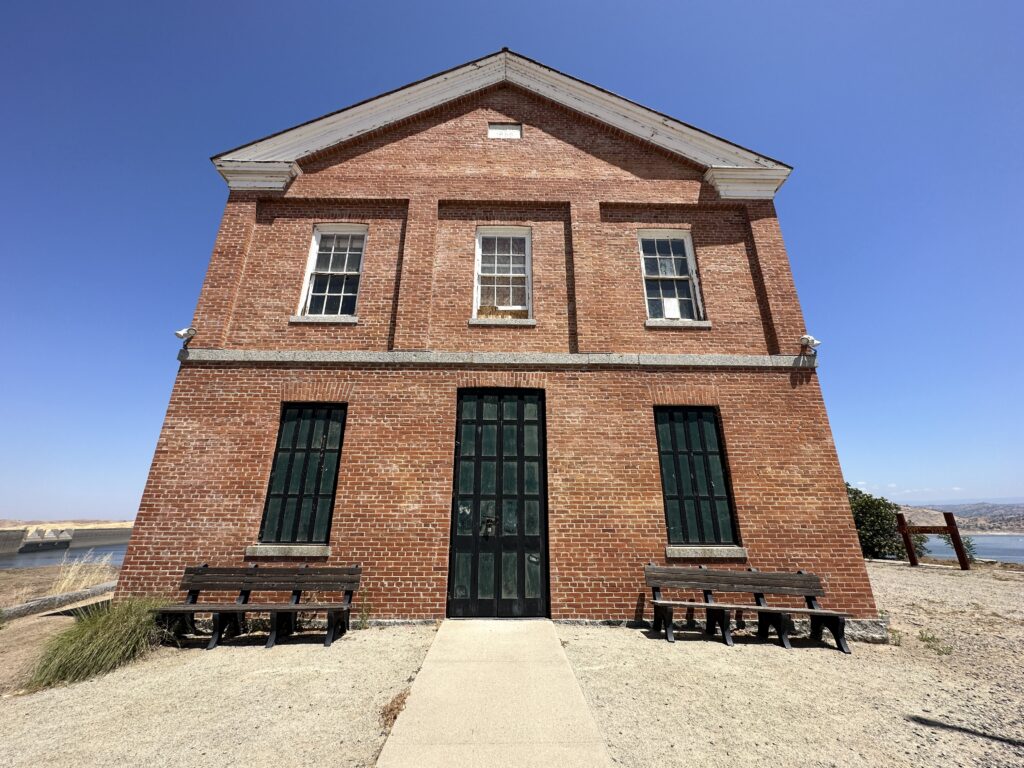
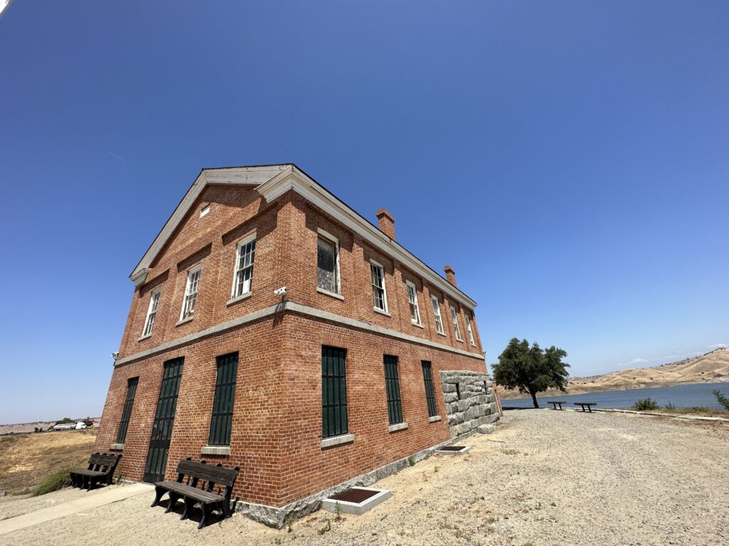
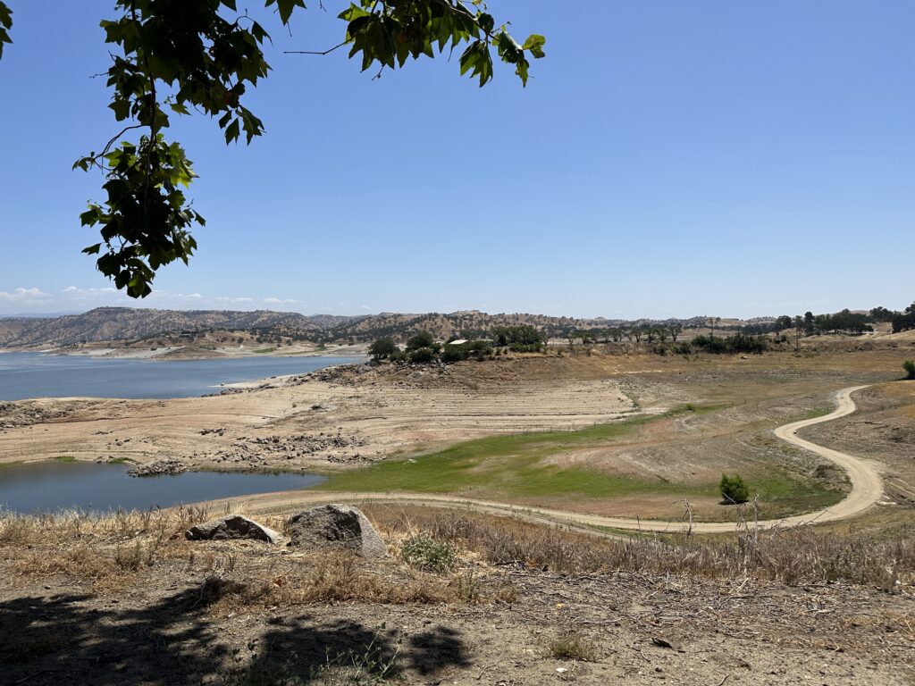
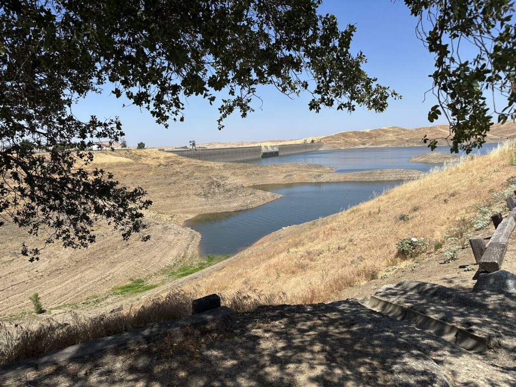
One of the fun things about wandering around the countryside as you get to meet some interesting people. I had wanted to see Friant Dam and Millerton Lake just because they were on the way and are an important part of water management in the area. But while I was there I ran into a really interesting guy and his friend.
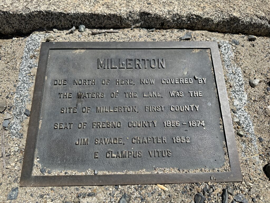
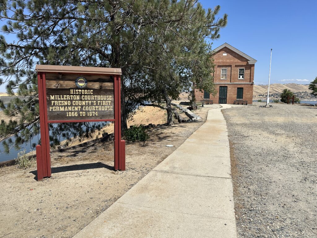
Millerton was a town in the valley that is now submerged in the lake. The courthouse in the photos below used to be located there. It was moved to higher ground to preserve it when the dam was built (1937–1942).
As I was walking from the parking area toward the courthouse I ran into these two guys. They had been there watching a fire helicopter practice doing water pick ups from the lake. The helicopter was back on the ground by the time I arrived, but we got to talking — as Californians do — about wildfires, various firefighting aircraft, etc. And then he told me a bit about the history of the area, and about his connection to it.
It turns out his dad, who was born in 1916, used to run a string of traps up and down the San Joaquin river, to earn money. He would hike up the river on one side, collecting anything ahead caught, at Millerton – near the courthouse – he would catch a nickel ferry to the other side, and hike back, checking his traps on that side as he went.
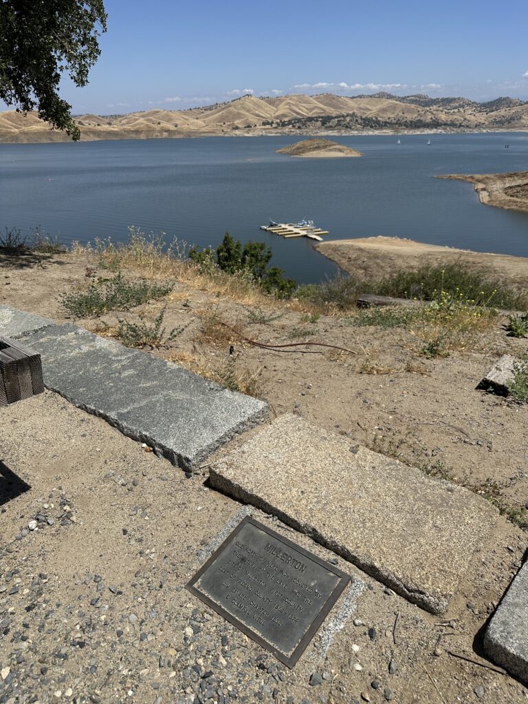
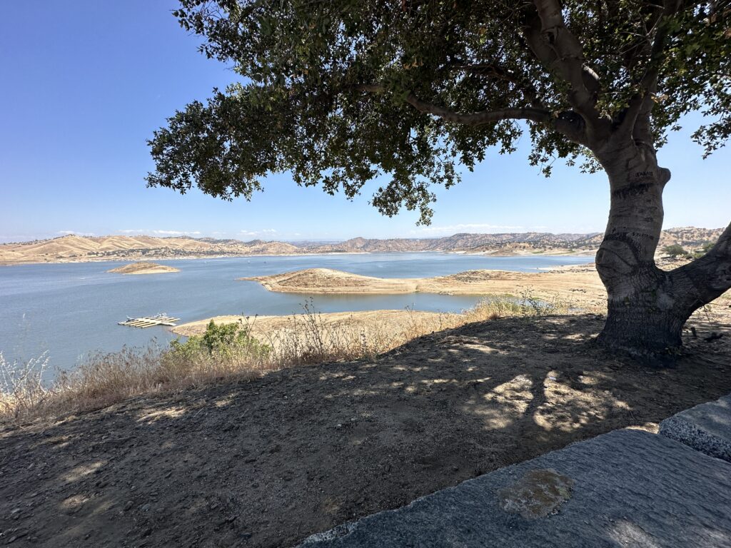
The two guys also explained the level of the lake. I asked if it was so low for lack of water, or as a flood prevention strategy. It was the latter. Apparently a couple of weeks ago the lake was absolutely full. You can see a wet high-water mark in some of the photos. It was so high it was starting to come over the emergency spillway.
Of course, that means that any additional water coming in has to go straight out – there’s no room in the reservoir to absorb the excess. And this damn is the last stop before all that water becomes a problem for the cities below. So they brought it down quite a lot – something like 75 feet in a matter of a couple of days. They said it was as high as they’d ever seen it, and also as low as they ever seen it, both in the course of the last week or two.
Before we parted ways they gave me a few tips on interesting things to see in that some of which I had planned already, and some which will have to wait for another trip. One of them really liked the Mining and Mineral Museum that I passed over today.
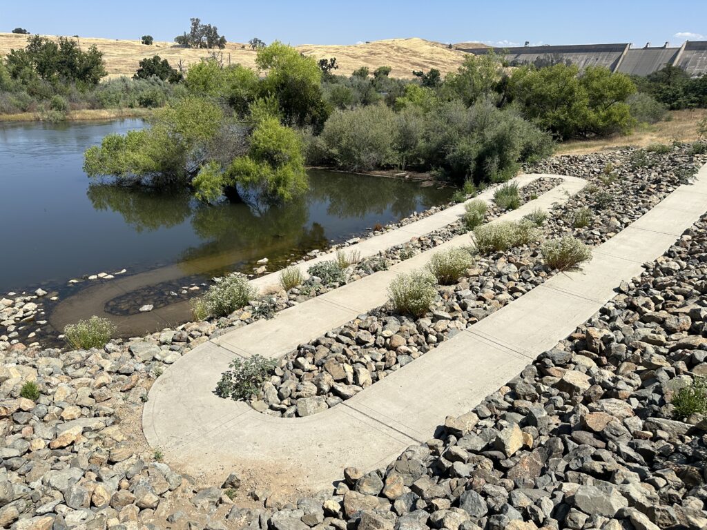
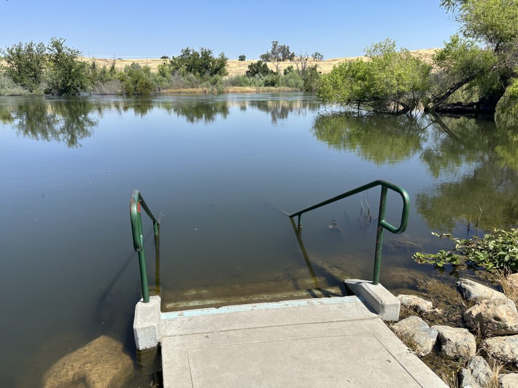
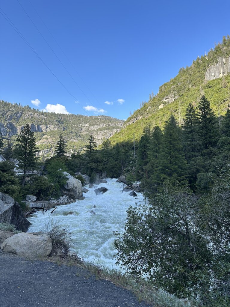
Just below the dam is a small parking area and viewpoint where you can walk down to the edge of the river. All the rivers in this area are closed to recreation right now because the levels are so high and the currents are so swift and powerful. But they are amazing to see, especially for me – a lifelong resident of San Diego County. We just don’t have this kind of water anywhere.
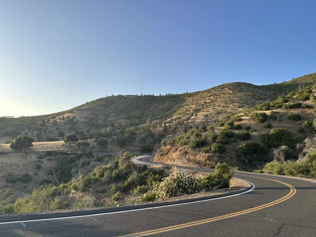
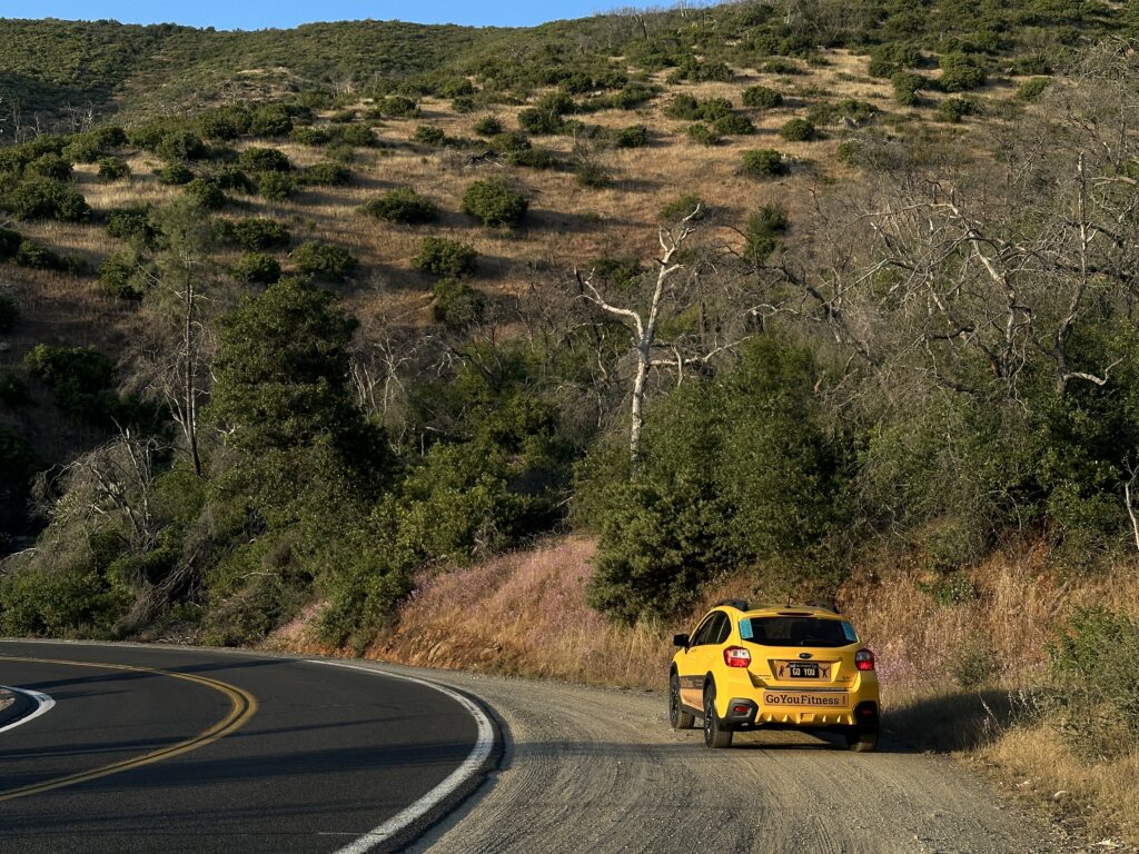
Highway 41, Up to Yosemite
I have been to Yosemite before, when I was a kid. It may have been 50 years ago! And I wasn’t the one driving.
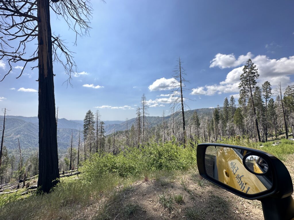
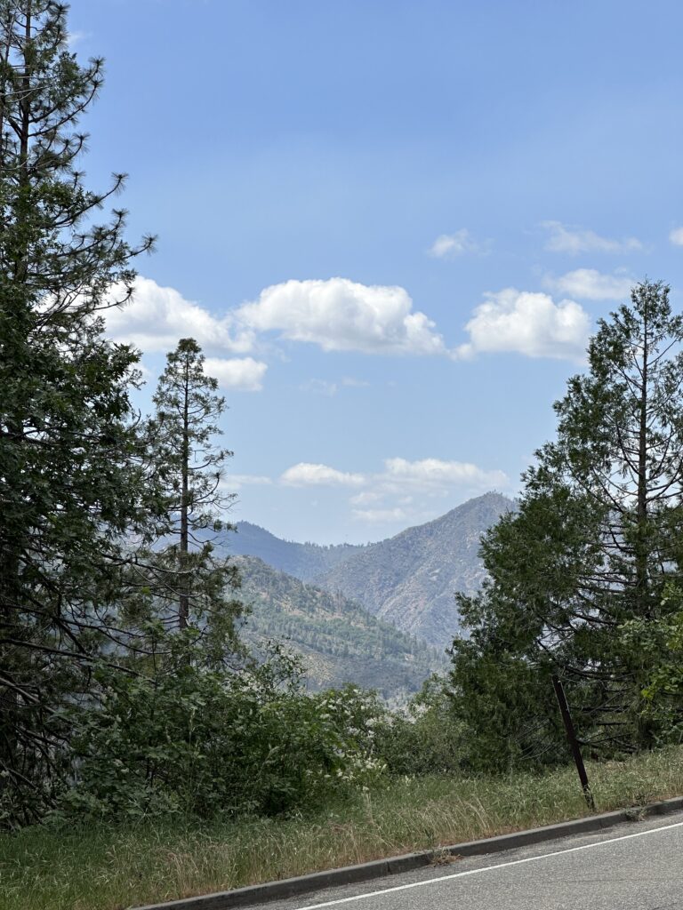
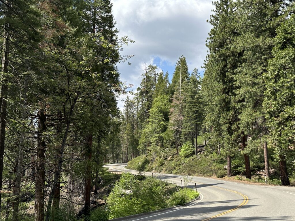
The trip up to Yosemite is amazing! More so because it is spring, and it was uncrowded. Highway 41 goes right through a major burn area. I don’t know the name of the fire, or how recent it was, but nature is taking over again, as it does.
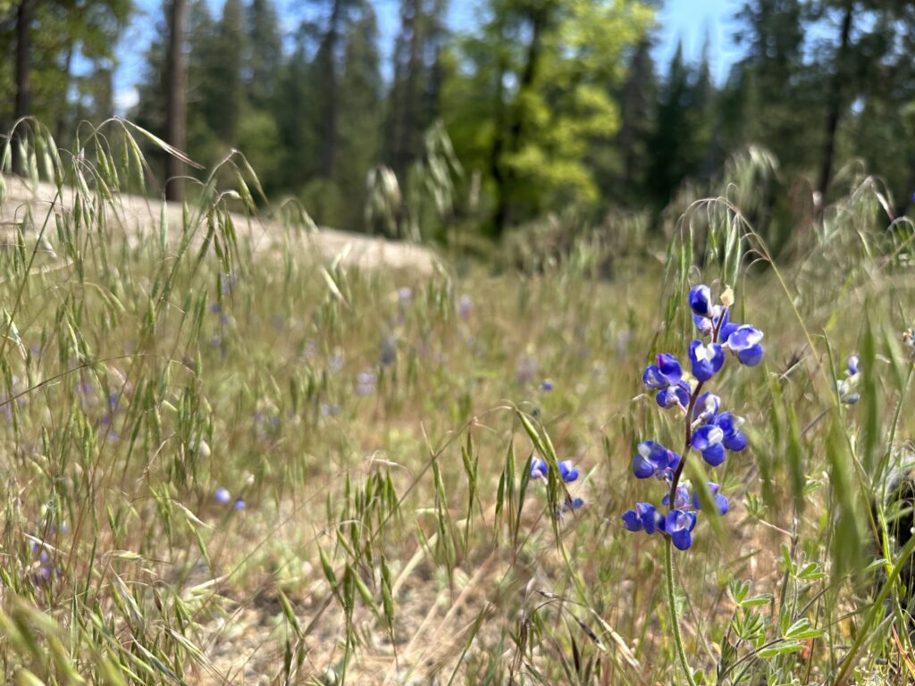
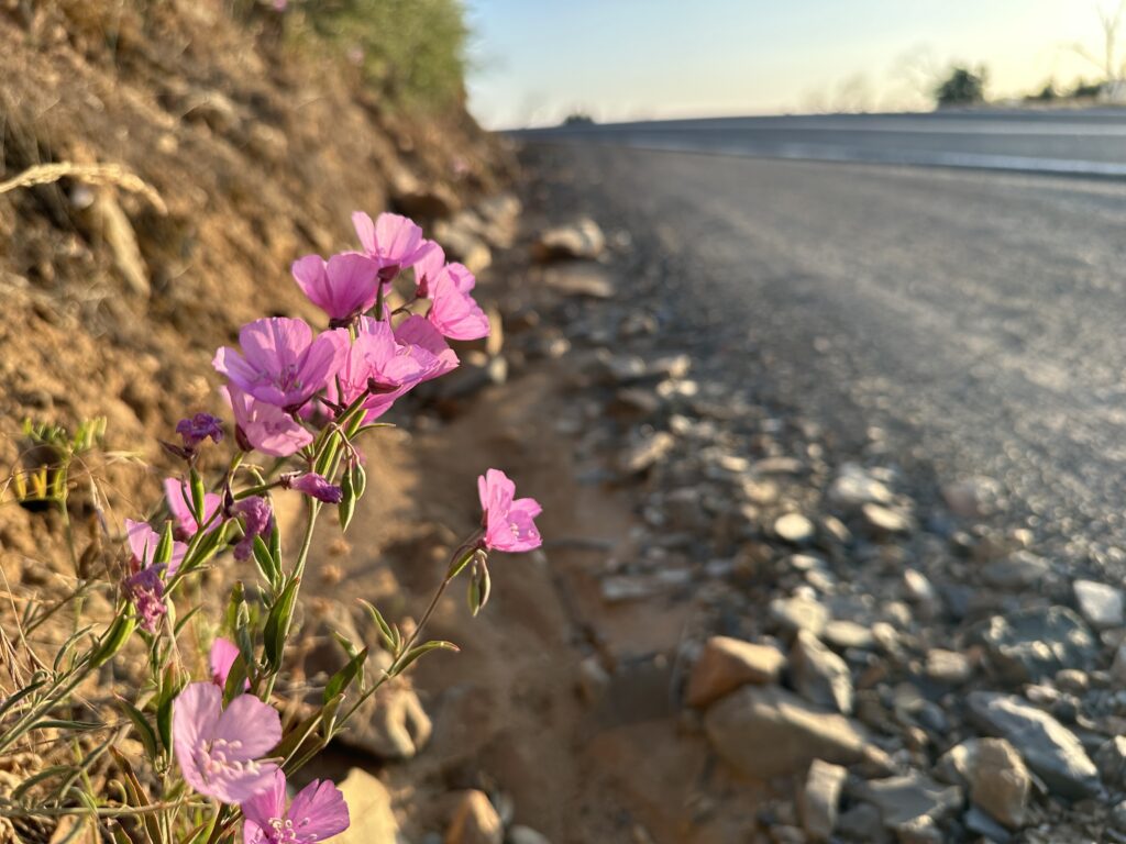
There were so many wildflowers! Somehow, none of them were near the turn outs. I kept seeing them go by in masses of pinks and purples and yellows, but when I would get to a wide spot in the road there were done to be found. I finally got a few pictures. This Lupine was growing right behind a dumpster near a restroom, where at last I could get a photo of it.
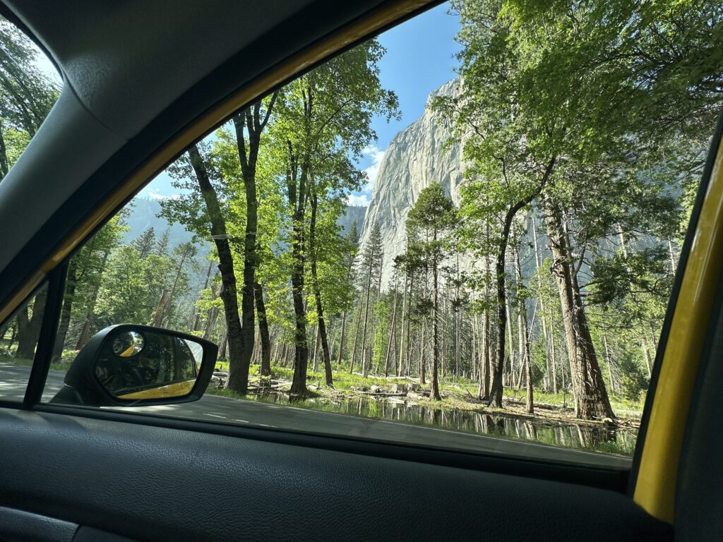
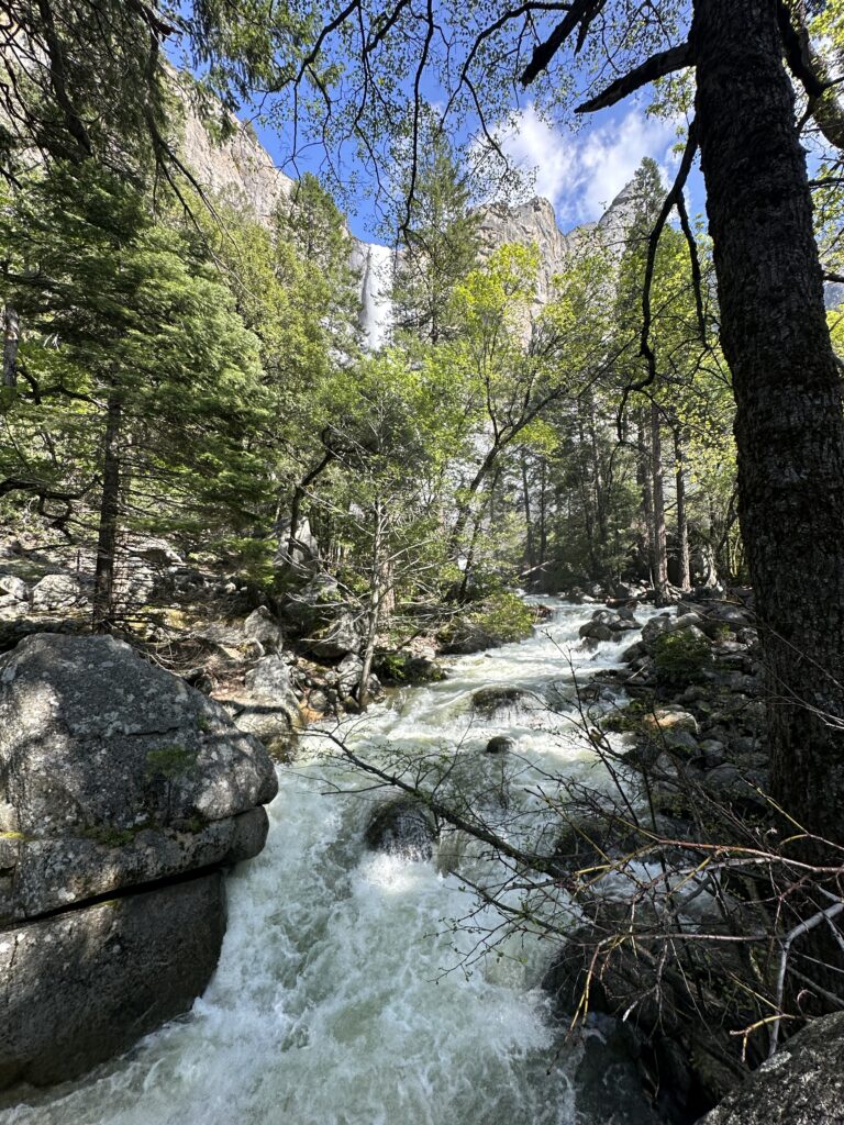
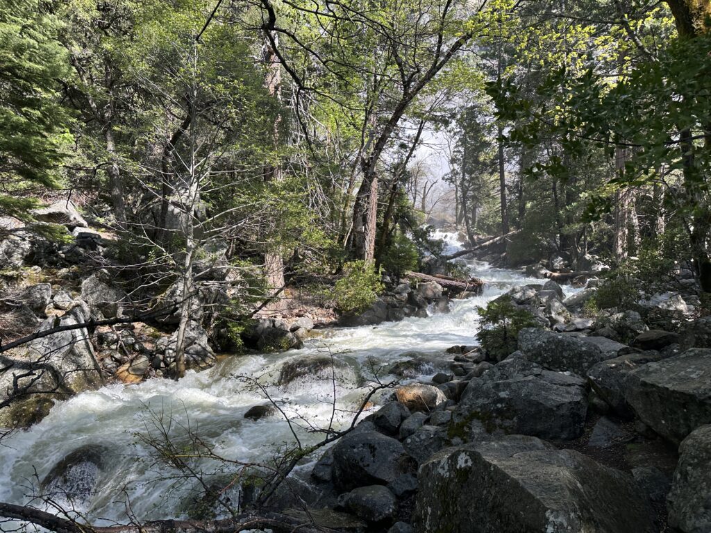
As you approach Yosemite Valley you start to see creeks with little waterfalls by the side of the road. Very exciting! I realized if you can hear the waterfall as you are approaching you probably should stop and look at it! So I did, a couple of times, and then I realized I needed to get moving I wasn’t going to get to the valley in time to see the really amazing stuff. Even so, it was hard to pass up the sites I was seeing, so I had to pull over now and then, in spite of being in a hurry.
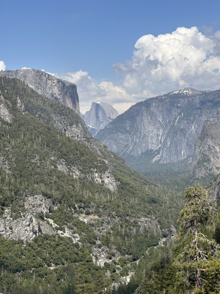
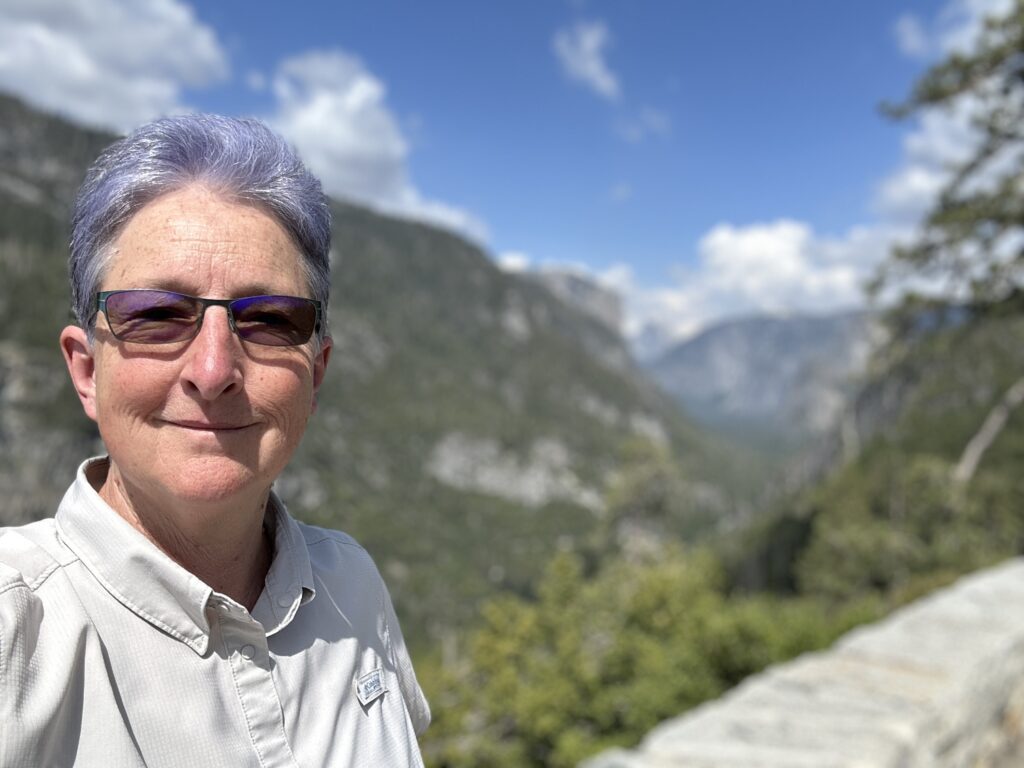
Yosemite Valley
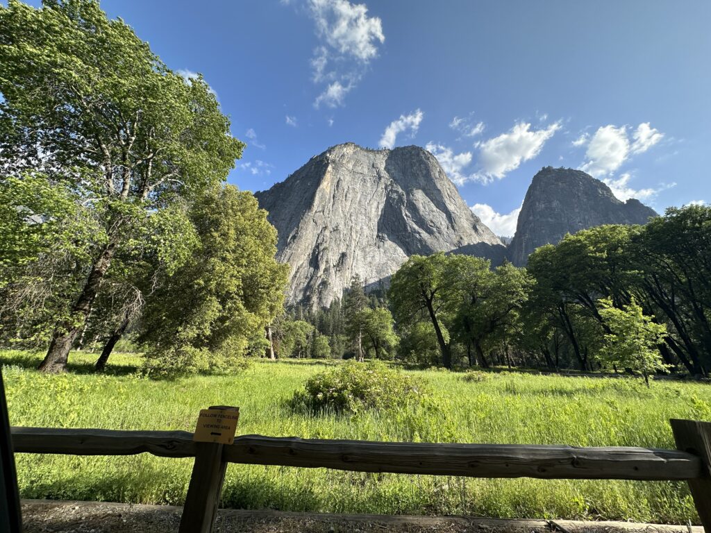
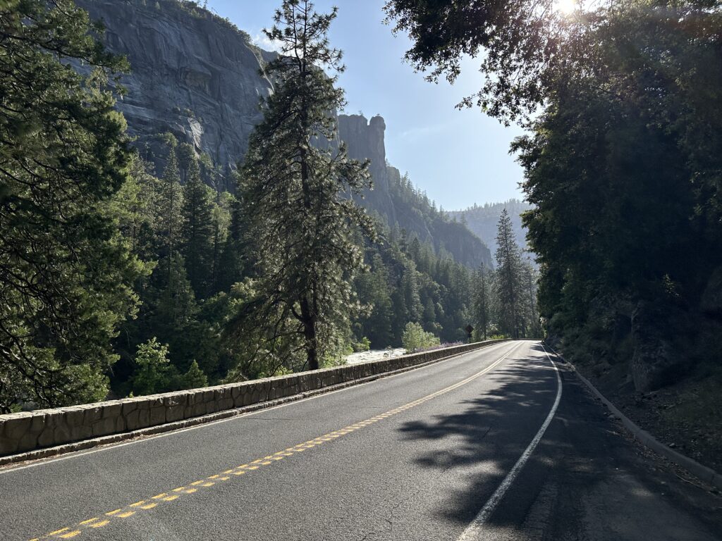
One of the things I found surprising about Yosemite Valley when I was reading about it in preparation for this trip is how small it is! It’s something like 7 miles long, and a mile or two across, if I remember correctly. There’s a road that goes one way, and a loop around it, so you go up one side, cross the river, and come back the other side. There’s parking pretty much all along the road, so you can get out almost anywhere and see the sights, which are stunning!
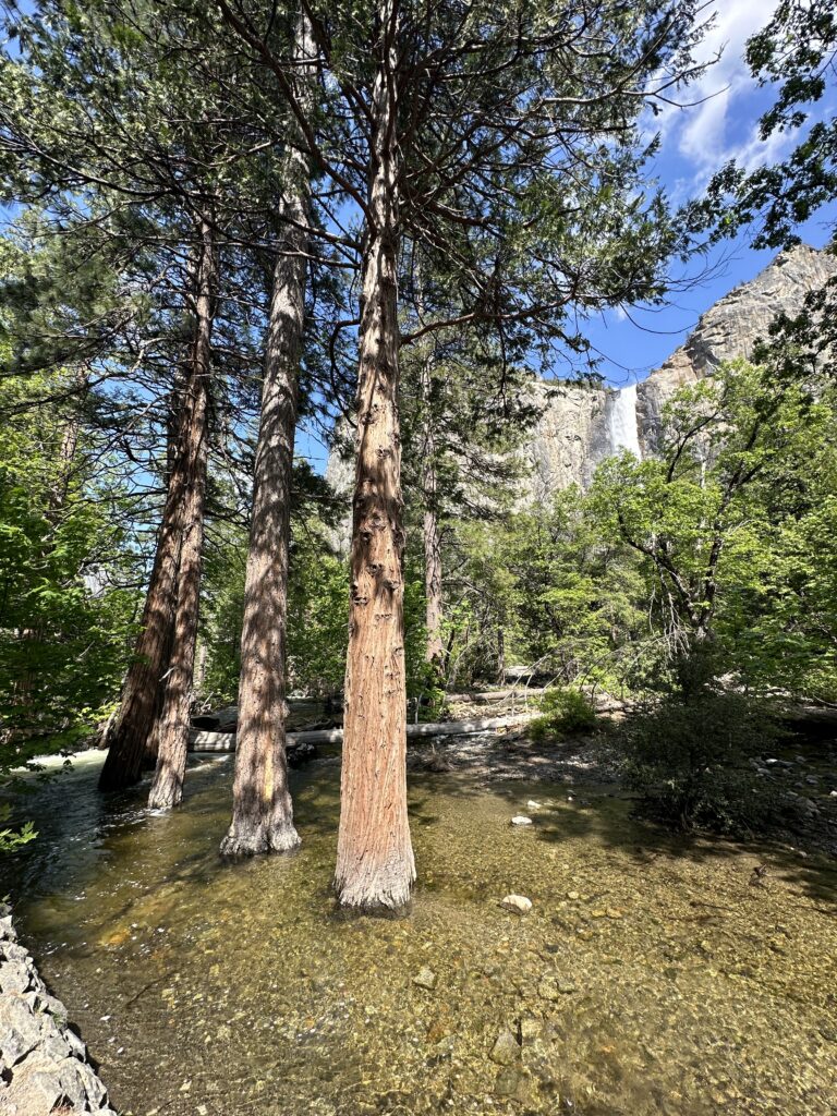

By the time I arrived in the valley I didn’t actually have a lot of time left to see things. I realized after the drive up that I needed to be down the hill before sunset, because I didn’t want to be navigating winding roads along raging Rivers in darkness. So I did a lot of pulling over, gawking for a few moments, taking a few quick photos, and moving on. Not the ideal way to see one of the most beautiful places on the planet, but for this trip it was either see it quickly, or don’t see it at all.
Everywhere you look are amazing views – on the way up, driving in the valley, and on the way back down. It’s a good thing there weren’t any children or sensitive people in the car with me because I’m sure half of my exclamations were not safe for mixed company.
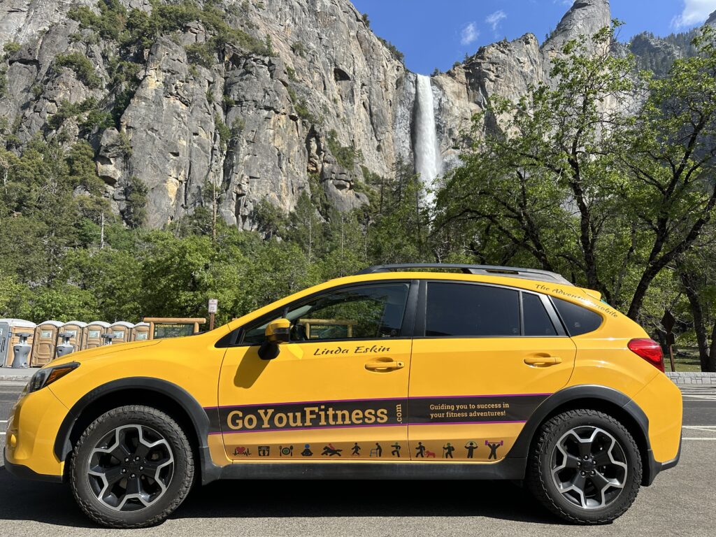
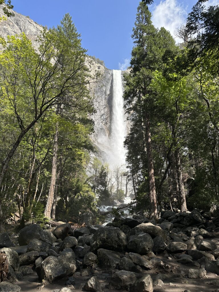
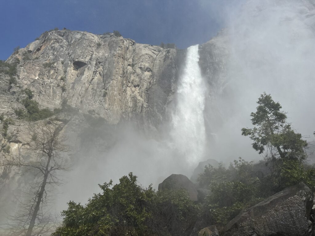
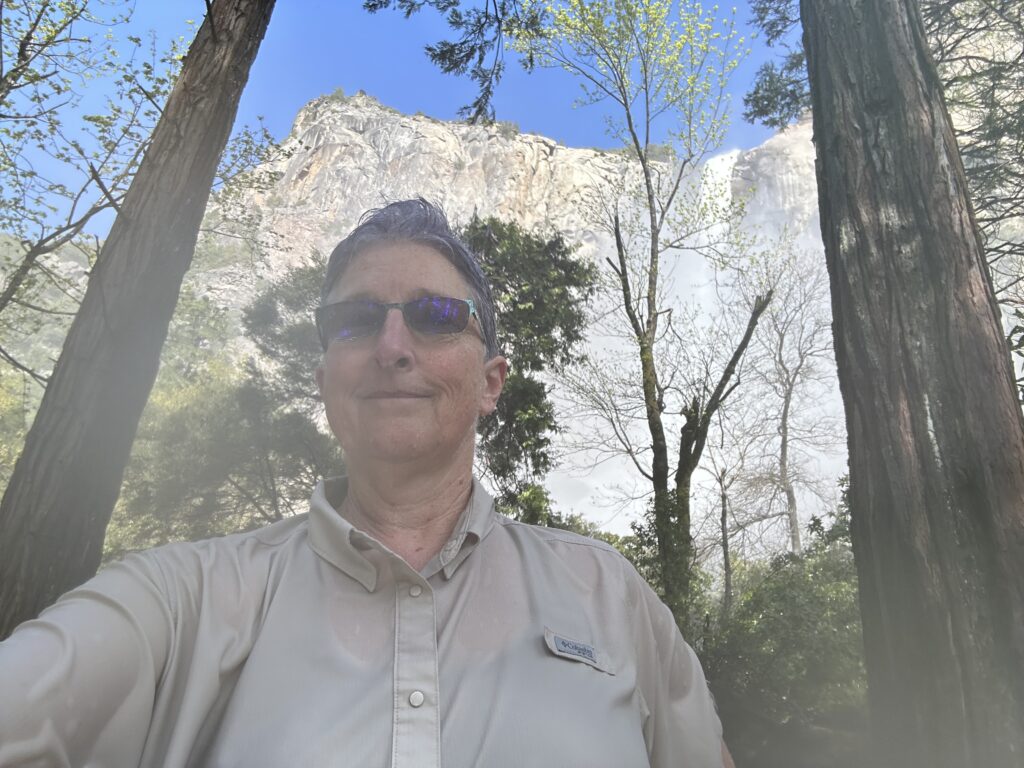
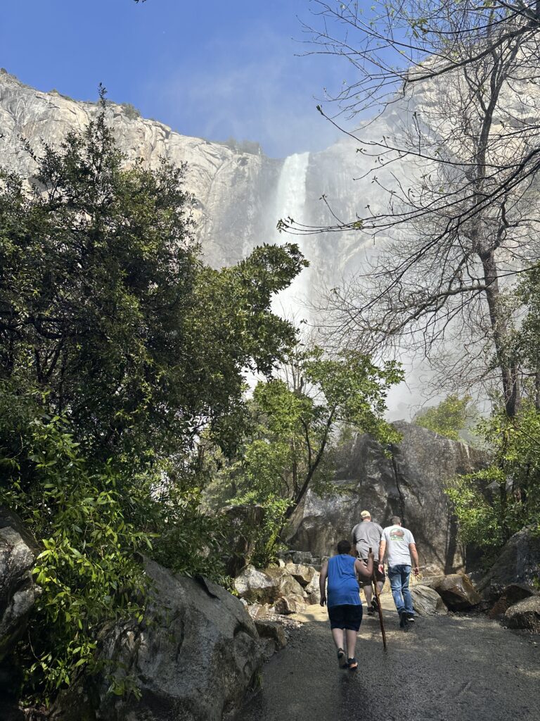
I did get away from my car and go for one short hike, which was really fun! I took the short trail up to Bridalveil Falls. As I was heading up, families were heading down, and som of the children were soaking wet! I know they were not playing in the river.
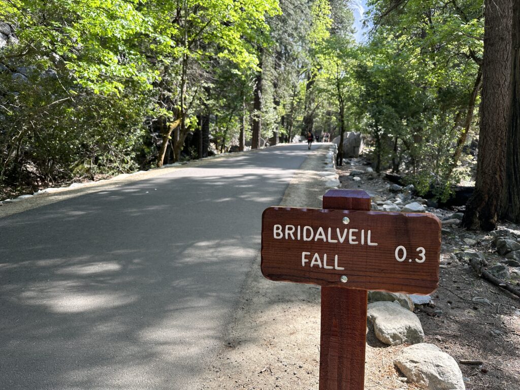
One of them finally randomly announced to me, just because she was so excited, that the waterfall was really fun! I figured that might be why she was soaked, and asked her if it was really cold. “Yes! But it’s fun!“ Sounds good to me, Kiddo. So I went off in search of where to play with the waterfall!
It turns out if you go past where all the people with nice cameras are turning around and going back, you go up a trail that takes a left and goes uphill. You start to feel the mist along way before this, but it gets intense here, like it’s raining.
A woman from Switzerland, at Yosemite for the first time – in fact in America for the first time – he been walking with me briefly, but headed back to drier ground at this point.
Go a little farther and you find a family huddled in the shadow of a giant boulder, taking a break from getting drenched. A little beyond that and you are in a proper rainstorm, with sheets of water washing over you. I am grateful that newer iPhones are water resistant. I was able to get some interesting photos and some really fun video. (Unfortunately, I am unable to post video here for the moment.) And by the way, it is impossible to wipe your lens dry when all of your clothes are wet!
140 and 49 – The Way to Angels Camp
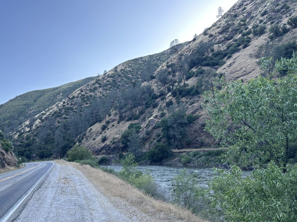
I’m going to keep this brief, because it’s time to get going. Let’s just say if I never drive Highway 140 or the south end of 49 again, I will be quite happy. 140 goes down a dramatic and beautiful canyon, side-by-side with the roaring Merced river. Thankfully, traffic was virtually nonexistent. After I let one long line of cars go by me, after we had all been held up for a construction project, I didn’t see another car going my way for at least 30 or 40 minutes. There are opportunities to turn out if there were cars that wanted to pass, but a lot of them include the risk of over shooting and going straight into the water.
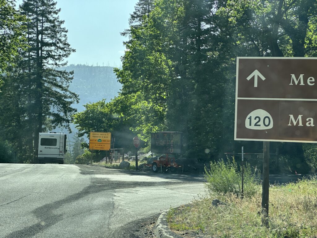
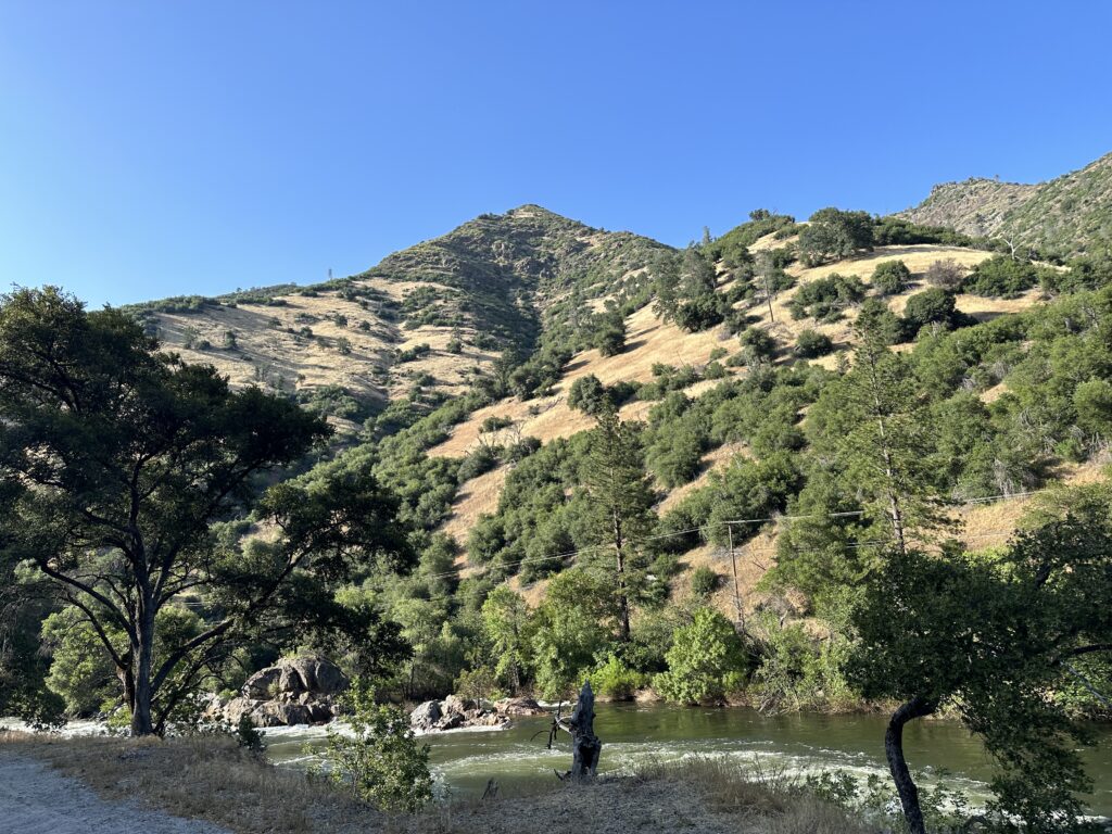
The south part of 49, south of Highway 120, is way more perilous than I expected. I imagined it to be nestled in the rolling foothills, but instead it is perched on the side of very steep mountains.
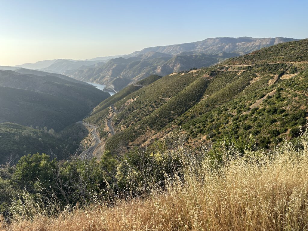
Neither road has much in the way of shoulders, and few guard rails, except at truly critical points. A moment’s inattention could easily get you killed, and I was driving these roads for hours. Definitely a both-hands-on-the-wheel experience!
if I were the sort of person to need a stiff drink, I certainly would have needed one when I arrived in Angels Camp. The scenery was gorgeous, but I think I will have to be content with having seen it just this once.
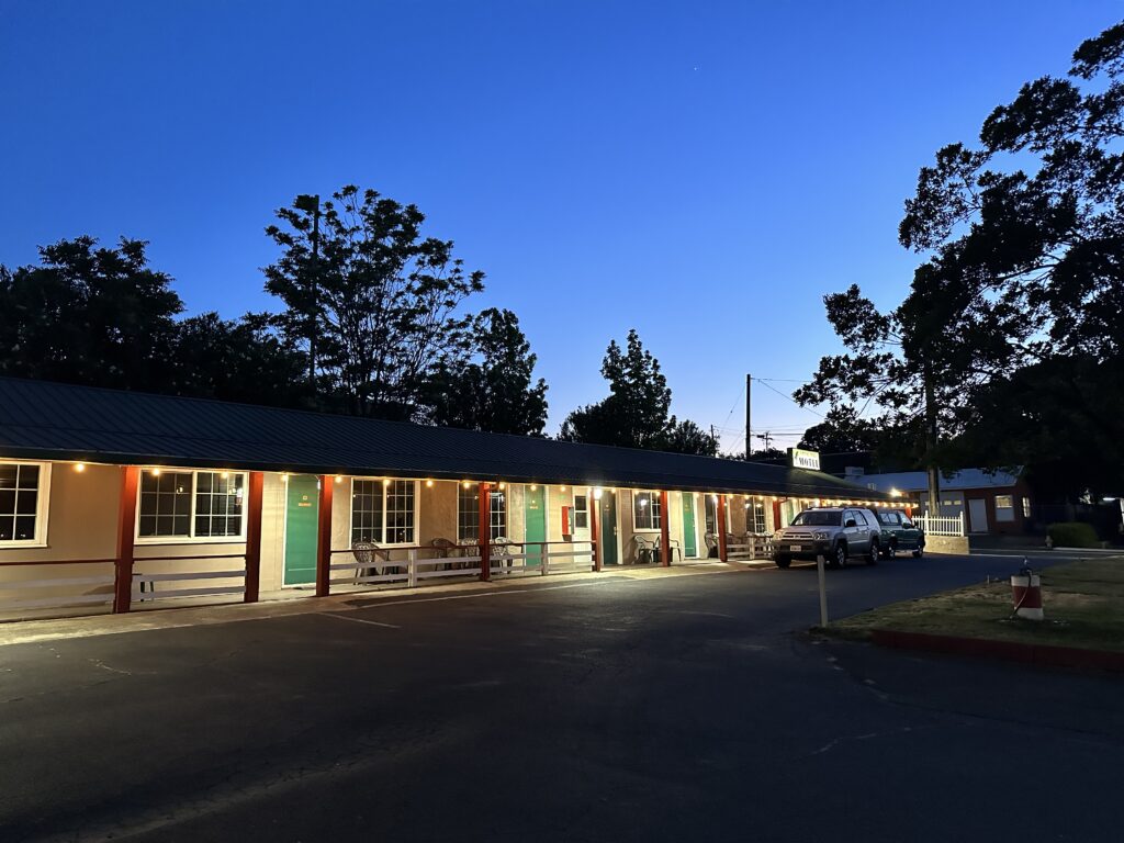
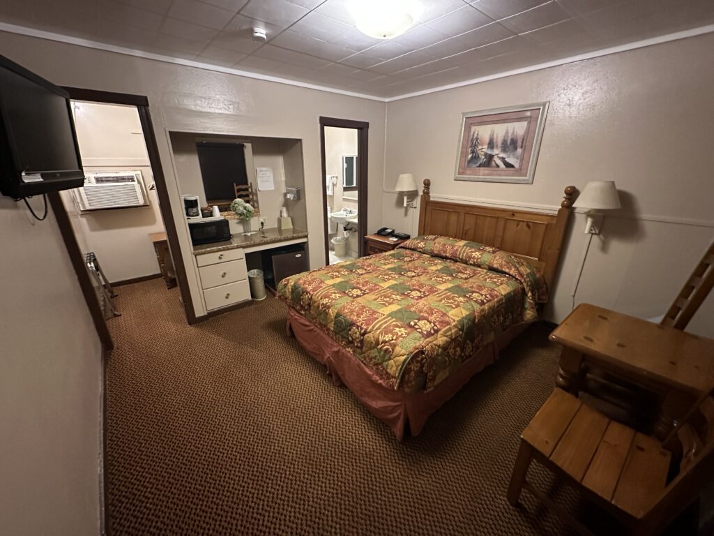
A Night at the Jumping Frog
This morning I’m writing from the charming Jumping Frog Motel in Angels Camp, in Calaveras County. A classic old motor lodge, with parking right in front of your room. Very cozy and friendly. I got here too late to go out to eat or pick up food, but thankfully the supermarket was still open, so I had microwaved enchiladas. Good enough!
What’s Next?
My plan for today is to drive from Angels Camp to Tahoe City, where our Aikido retreat begins late in the afternoon., my current plan is to take Highway 88 up into the high Sierra, poking around along the way. It should be a beautiful drive!.
I am looking forward to seeing my Aikido friends! This retreat did happen last year, but I wasn’t ready to be around so many people, so this will be the first time I’ve seen them since 2019.
Further Exploration for Today’s Adventures
A few more links, if you want to dig further:
California State Mining and Mineral Museum
Calaveras Big Trees State Park
Also be sure to check out my post, California History Resources for Road Trips, where I share several excellent books/audiobooks, tours, videos, and websites.
About the Author — Linda Eskin
Linda Eskin began practicing Aikido in 2009, at age 46. From the beginning she was inspired to explore how Aikido is taught and learned. In addition to mentoring adults, and now teaching a weekly Focus on Fundamentals class for students of all ranks, she assisted in the children’s programs for over eight years.
Linda loves Aikido both from the technical perspective, and as a practice of awareness and embodiment. She is completing her forthcoming book, Aikido to Zanshin – 26 Essays on the Martial Art of Peace.
Linda’s passion is encouraging people to begin, and supporting new learners of all ages.
Linda trains with Dave Goldberg Sensei at Aikido of San Diego, in California, and holds the third black belt rank, sandan.


